Wildfires in Attica: Managing a Multi-Risk Challenge in the Age of Climate Crisis

Written by Ioannis Kapris, Civil Protection, Region of Attica
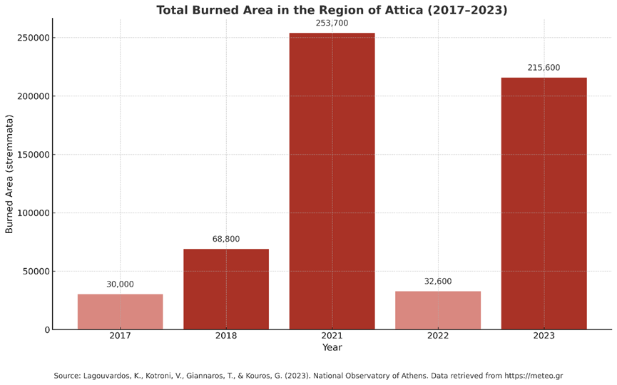
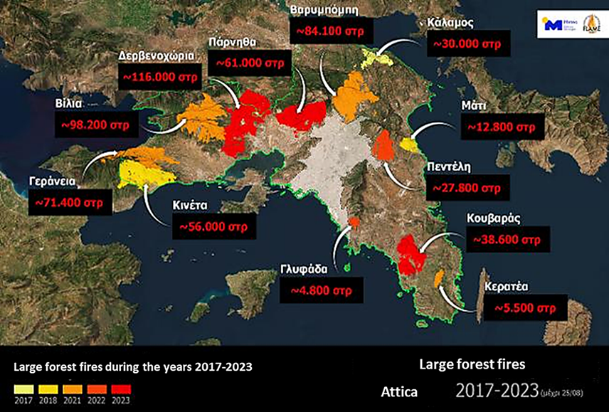
Between 2017 and 2023, over 1.23 million stremmata (123,000 hectares) of land burned in the Region of Attica due to 12 major wildfires, with more than 600,000 stremmata burned in just two of those fires (2021 and 2023). Alarmingly, 33% of Attica’s forested land has been lost in just seven years (Lagouvardos et al., 2023). These figures highlight the escalating wildfire threat under climate stress.
For the Directorate of Civil Protection of the Region of Attica, these numbers represent more than statistics—they are a call to action. Managing risk in one of Europe’s most densely populated regions is a complex and high-stakes mission. Attica, with a population density exceeding 1,000 inhabitants/km² (Eurostat, 2023), is home to over one-third of Greece’s population according to the 2021 census (ELSTAT, 2023). This demographic reality adds pressure to an already demanding operational landscape, requiring coordination across tightly interwoven residential and forested zones.
This challenges underscore the importance of impact-based, multi-risk early warning and response systems, like the systems that GOBEYOND is developing. Tools that integrate hazard forecasts with exposure and vulnerability data empower local authorities to act faster and smarter, protecting lives, forests, and urban areas alike. In a landscape where multiple hazards—fires, floods, heatwaves—interact, decision-support systems are not just useful; they are essential.
Attica’s civil protection efforts are at the frontline of Europe’s fight against climate-driven disasters. And we’re just getting started.
References:
• Lagouvardos, K., Kotroni, V., Giannaros, T., & Kouros, G. (2023). Εθνικό Αστεροσκοπείο Αθηνών – Μεγάλες δασικές πυρκαγιές Αττικής 2017–2023. Retrieved from https://meteo.gr
• Eurostat. (2023). Urban audit: Metropolitan regions population density. Retrieved from https://ec.europa.eu/eurostat
• Hellenic Statistical Authority (ELSTAT). (2023). 2021 Population Census – Final Results. Retrieved from https://www.statistics.gr
- Published in News
Advancing Impact-Based Early Warning in Switzerland: GOBEYOND’s Work in Zurich and Ticino

In the Swiss cantons of Zurich and Ticino, GOBEYOND partners are advancing the co-design of an adapted version of the project’s Multi-Risk Impact-based Early Warning System (MR-IEWS). Led by the Federal Office of Meteorology and Climatology MeteoSwiss, this work focuses on testing and refining an impact-based approach to risk communication through the development of a tailored prototype platform that can support faster, more informed responses in the face of natural hazards.
Understanding the Local Context
The two pilot regions offer contrasting conditions. Zurich is densely populated (1.5 million inhabitants), in an urban context, with relatively flat geography (altitude between 330 and 1290 m) and Swiss German speakers. On the other hand, the canton of Ticino is sparsely populated (0.3 million inhabitants), in a rural context, with mountainous relief (altitude between 190 and 3400 m) and Italian speakers.
The hazards these regions face range from storms, heavy precipitation and flash floods to heatwaves, wildfires, landslides, snow and avalanches. Not all hazards are equally relevant for Zurich and Ticino. A particular challenge lies in the warning system for water-related events: there is a gap between short-term thunderstorm alerts (typically issued up to one hour in advance) and long-duration rainfall warnings. This leaves fast-evolving hazards like flash floods and surface runoff largely unaddressed. Additionally, complex multi-hazard events—such as combinations of hail, intense rainfall, storms, and lightning—further complicate the response efforts of first responders.
Due to the decentralized, federal nature, the warning chains and responsibilities between communal and cantonal authorities and response entities are different between the two case study regions, and at times convoluted. Understanding these is key and an important component of the project.
From Hazard to Impact: Bridging the Gap
Switzerland already benefits from a strong foundation in risk communication through the GIN platform—a national, multi-hazard information system developed and operated by federal authorities. This platform, which has been in operational use for years, provides valuable hazard-based warnings to all Swiss cantons. However, it does not currently offer impact-specific insights, leaving a critical gap in decision-making support during natural hazard events.
GOBEYOND is working to bridge this gap, through a tailored version of the project’s Multi-Risk Impact-based Early Warning System (MR-IEWS), which will be developed specifically for Swiss needs. By combining hazard data with exposure and vulnerability indicators, the platform aims to give emergency services and local authorities the tools they need to anticipate consequences and respond more effectively.
Co-Creation Through Stakeholder Workshops
A key element of this work is the active involvement of local stakeholders. MeteoSwiss has organized a series of workshops to ensure that the platform is built around real-world operational needs. The first round of stakeholder engagement took place in September 2024, engaging key actors such as the Cantonal Police, Civil Protection Offices, Flood Protection Office, Ambulance Services, Fire Brigades, Natural Hazard Experts as well as the Community Mayor. These initial sessions gathered insights on existing challenges and the types of information that would support better preparedness and response.
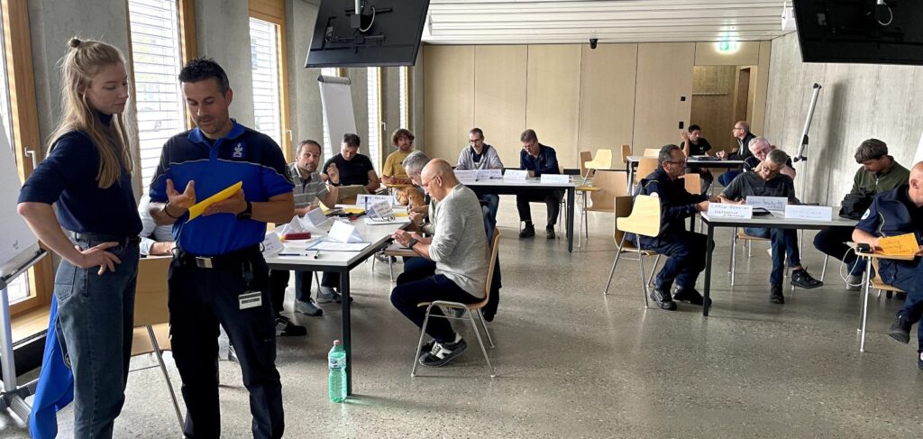
The dialogue continued in April 2025 with a second round of workshops in both pilot regions. These sessions focused on concrete use cases and scenarios where impact-based information could significantly enhance decision-making compared to conventional hazard warnings. Participants worked collaboratively to define how such systems could be used in practice, what data sources are most relevant, and how to align warning outputs with the needs and timing of different user groups.
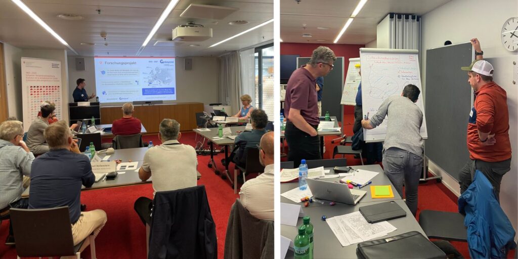
What’s happening in Zurich and Ticino is a clear example of the GOBEYOND philosophy: innovation driven by co-creation. By involving those on the front lines of emergency response, the project ensures that its tools are not only technically advanced but also tailored to the complex, real-world conditions in which they will be used.
The scenarios and use cases identified during the second round of workshops form the basis for the subsequent work. For selected use cases in both pilot regions, prototype applications providing targeted, impact-based information to specific user groups are developed. These prototypes are iteratively refined through discussions and workshops with local authorities. Following this process, the final solutions will be integrated into existing workflows at MeteoSwiss, with outputs made available through the Swiss national platform for natural hazards, GIN.
- Published in Living Labs, News
Publication: Rapid Fatality Estimates after Earthquakes in Western Mediterranean Countries for First Response

After large earthquakes worldwide, local communications are usually knocked out, but potential international rescuers need to know whether or not to respond. The International Centre for Earth Simulation Foundation, associate partner of the GOBEYOND project, issues estimates of the number of fatalities within 25 minutes, on average, for worldwide large earthquakes. In the project, they are working to reduce this delay to a few minutes by automating their calculations and including information on size and location of earthquakes from operators of regional seismograph networks because time matters in the race for first responders to rescue injured people.
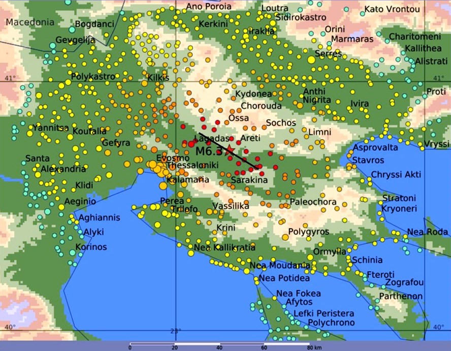
They have calibrated their calculation tool based on past earthquakes that have caused fatalities in Italy, Greece, Morocco and Spain; thus, they are confident that they can distinguish disastrous from inconsequential earthquakes in the Western Mediterranean area within minutes. An example of their estimate of shaking due to a magnitude M6.2 earthquake in Northern Greece is shown in Figure 1. The calculated intensities and fatalities match the observed ones.
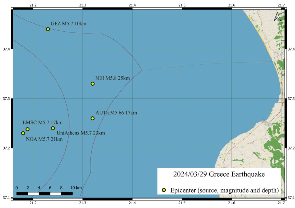
The greatest remaining challenge is to know an accurate location within minutes, which is needed for reliable estimates of fatalities. The variations of location estimates for an M5.7 in Greece reach 10 km and more (Figure 2). The only remedy is to obtain location estimates from regional seismograph networks capable of accurate locations.
This study, conducted by Max Wyss and Philippe Rosset from the International Centre for Earth Simulation Foundation, Geneva, Switzerland, was recently published in the Bulletin of the Seismological Society of America and is available on request from max@maxwyss.ch.
- Published in New publications, News
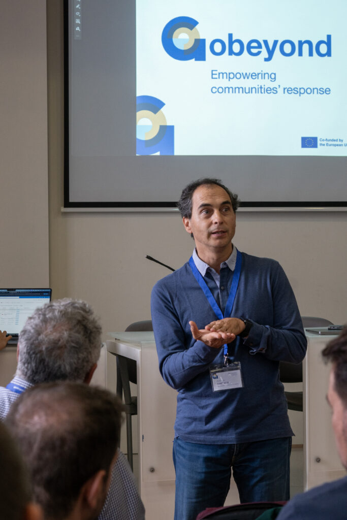
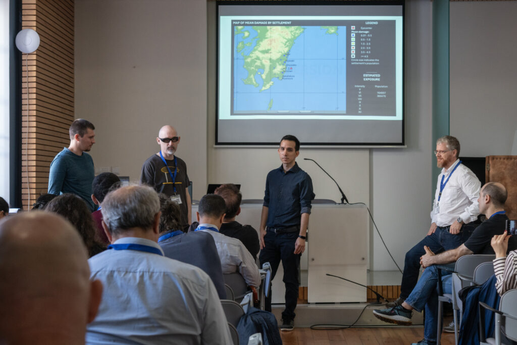
1st GOBEYOND Workshop

From 18 to 20 March 2025, the GOBEYOND consortium gathered in Sevilla, Spain for three days of collaboration, innovation, and strategic alignment—marking a key milestone in the project’s journey toward enhancing disaster preparedness across Europe.
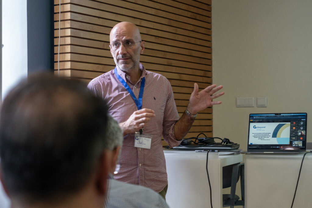
The first two days, 18–19 March, were dedicated to the 1st GOBEYOND Workshop, which welcomed around 100 participants from across Europe and beyond. The event brought together civil protection authorities, first responders, researchers, policymakers, and key stakeholders, all committed to building more resilient communities in the face of geo-, weather-, and climate-related hazards.
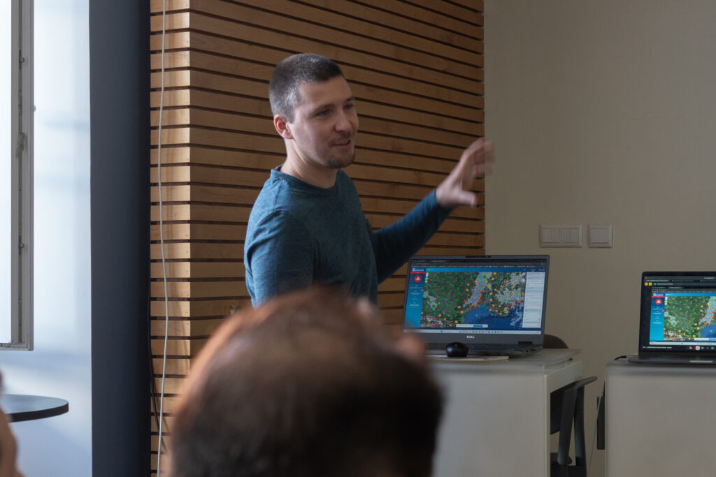
The workshop was filled with insightful discussions and interactive sessions, featuring seven thematic roundtables where experts exchanged ideas on risk communication, user needs, platform development, and more. A significant highlight was the live demonstrations of the GOBEYOND Multi-Risk Impact-based Early Warning System (MR-IEWS) prototypes, where participants engaged directly with the tools. In parallel, a poster session sparked meaningful exchanges, showcasing the diverse contributions and perspectives of stakeholders.
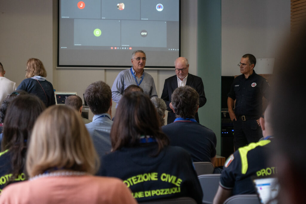
On 20 March, the consortium met at the 112 Andalucía Centro de Coordinación de Emergencias to reflect on project progress, align on upcoming actions, and consult with the Advisory Board. The day also featured a major highlight: the selection of the GOBEYOND Innovation Prize winner.
After a pitch session with the three finalists—Alberto Michelini with ShakeMapEU+, Andrea Trucchia with FAIR, and Milan Kalas with Imagine—the consortium voted to award the prize to FAIR – Forest Fire AI-based Risk Assessment from CIMA Research Foundation. This innovative solution will now be integrated into the GOBEYOND platforms, strengthening the project’s impact and technical capabilities.
📅 Save the Date: The 2nd GOBEYOND Workshop will take place on 21–23 April 2026 in Pozzuoli, Italy.
- Published in Consortium Meetings, News
Evaluating Multi-Hazard Dynamics in the Campi Flegrei Volcanic Complex

Aldo Zollo – Department of Physics University of Naples Federico II
The Campi Flegrei caldera in southern Italy is one of the most fascinating and complex volcanic systems on Earth. Nestled in the metropolitan area of Naples, it is home to nearly half a million people. Far from being a dormant relic, Campi Flegrei remains lively and unpredictable, showing signs of unrest that include ground uplift, seismic activity, and gas emissions. These signals reflect the caldera’s intricate subsurface processes, where magma interacts with a gas-rich hydrothermal system, creating pressure changes capable of reshaping the landscape above and posing both geological and societal challenges.
A Brief Geological History
Campi Flegrei has a nested caldera structure formed by two major explosive eruptions: the Campanian Ignimbrite, about 39,000 years ago, and the Neapolitan Yellow Tuff, about 14,500 years ago. Each eruption expelled massive amounts of volcanic material and left behind a depression—called a caldera—whose boundaries now extend partly beneath the Bay of Naples. After these catastrophic events, over 70 smaller eruptions have occurred within the caldera in the last 15,000 years. Many of them were localized along structural weak points, where faults or fractures provided easier pathways for magma or high-pressure gases to rise.
This area, particularly the central part of Pozzuoli, has been marked by repeated episodes of uplift and subsidence—known as bradyseism—often accompanied by earthquakes. Since about 10,500 years ago, periods of unrest have been tightly linked to caldera resurgence in the central sector. When measured using modern geodetic techniques, the ground deformation shows a classic “bell-shaped” pattern centered on Pozzuoli, where the largest vertical changes occur.
Bradyseism Through the Decades
Over the past 70 years, Campi Flegrei has undergone several significant bradyseismic cycles. Two major uplift episodes in 1970–72 and 1982–84 triggered more than 20,000 earthquakes, causing extensive damage to buildings, roads, and pipelines, and forcing the evacuation of part of Pozzuoli’s historic center. After 1985, the caldera subsided for two decades, and seismicity subsided with it. However, since 2005, a new phase of ground uplift has been in progress. At times, this uplift rate has reached as high as 15 millimeters per month, correlating with noticeable increases in the frequency and magnitude of earthquakes.
As of 2023, deformation rates have risen to about 1–1.5 centimeters per month, with up to 1,000 earthquakes recorded monthly. While most earthquakes are small (magnitude 1 or less), they have recently included events in the magnitude 3–4 range, and one notable earthquake in May 2024 reached magnitude 4.4. Although this shaking is felt strongly near the epicenters, it typically decreases rapidly only a few kilometers away, thus limiting widespread structural damage. Still, scientists and civil authorities remain vigilant, as even moderate earthquakes can pose risks in an urban setting.
Why the Ground Moves: Magma or Hydrothermal Fluids?
One of the biggest scientific debates at Campi Flegrei centers on the source of the unrest. Some researchers propose that magma intruding at shallow depths increases the pressure below the surface, lifting the ground and shaking the region. Others contend that hydrothermal fluids, rich in water and gas, explain the phenomenon. These fluids can become pressurized by deeper injections of gas from magma reservoirs and trigger the reactivation of fractures near the surface.
Seismic reflection studies and three-dimensional tomography did not detect any substantial magma accumulation at depths where most unrest occurs, typically less than 3 kilometers. Instead, these surveys reveal regions with high gas content or other evidence of hydrothermal activity. This does not rule out the possibility that small pockets of magma may exist at shallow depths, but it underscores the likelihood that fluid migration—and the pressure changes it causes—plays a central role in shaping Campi Flegrei’s unrest.
Mapping Faults and Relocating Earthquakes
To better understand the structure and behavior of Campi Flegrei, scientists use precise earthquake relocation methods, which refine hypocenter positions by reducing uncertainties in seismic data. This approach allows researchers to identify the specific faults and fractures activated during uplift episodes. Recent multi-scale relocation studies reveal an elliptical pattern to the seismicity, with shallow earthquakes beneath Solfatara-Pisciarelli and northern Pozzuoli. Offshore, earthquake depths generally increase.
These relocations also help experts evaluate the potential for larger events. Based on the geometry of the faults and historical data, ruptures could occur that reach moment magnitudes between 4.4 and 5.1. While not as powerful as the large earthquakes seen in other parts of Italy, a magnitude 5 event in a densely populated urban area remains a critical concern for civil protection agencies and local communities.
A Multi-Hazard Perspective
Beyond the risk of ground shaking, Campi Flegrei’s reawakened hydrothermal system, along with its history of moderate-size eruptions, calls for a broader assessment of volcanic hazards. Even a modest eruption could send ballistic blocks into the air, generate pyroclastic flows, and deposit ash across Naples. In many respects, the most common scenario might not involve fresh magma reaching the surface at all. Instead, phreatic or hydrothermal explosions—triggered when high-pressure fluids encounter cooler groundwater or come into contact with a confining layer—could still wreak havoc.
Historical accounts, especially those from the last eruption in 1538 at Monte Nuovo, indicate that significant uplift and persistent seismicity preceded volcanic events. This reaffirms that monitoring seismic activity is crucial for detecting early signs of volcanic unrest. However, not every uplift episode leads to an eruption; indeed, many phases of bradyseism over the last half-century ended without magma breaching the surface.
How Scientists Monitor and Model the Caldera
The National Institute of Geophysics and Volcanology (INGV) and other agencies maintain an extensive observing system at Campi Flegrei. Instruments measure ground deformation, seismic waves, gravity variations, gas emissions, and chemical changes in fumaroles and groundwater. Data arrive in real time, enabling scientists to detect anomalies quickly and send alerts to Civil Protection authorities, who coordinate evacuation plans if necessary.
To better plan for potential hazards, researchers combine observational data with advanced modeling tools. For instance, probabilistic analyses use historical patterns of bradyseism, seismic swarms, and eruptions to gauge how likely future unrest events might be. Agent-based simulations model how people and infrastructure would respond to evacuation orders or disruptions caused by ground deformation and shaking. Meanwhile, engineers conduct structural assessments to see if buildings in the region can withstand scenario-based earthquakes.
Risk Management and Resilience
Modern building codes typically focus on earthquakes expected over a multi-decade time scale, but the relatively small earthquakes at Campi Flegrei, occurring during bradyseism, can still cause localized damage. Recent research points out that standard seismic design may need to consider local, near-surface fault ruptures triggered by ground uplift. Reinforced concrete buildings fare reasonably well against moderate ground shaking, but older structures might require retrofitting to reduce collapse risks.
Risk management strategies must also acknowledge the unique interplay of multiple hazards: volcanic activity, seismicity, and ground deformation. Evacuation planning, infrastructural upgrades, and the clear communication of risks to residents all figure into the region’s civil defense strategies. The Italian Civil Protection system has developed various alert levels, which escalate if monitored data suggest that unrest is intensifying or an eruption becomes more likely.
Looking Ahead
Ongoing scientific efforts aim to refine the understanding of Campi Flegrei’s inner workings. By integrating high-precision earthquake relocations, satellite-based ground deformation surveys, and advanced geochemical analyses, researchers can better forecast how pressure builds and dissipates underground. These insights help narrow down the scenarios in which seismicity or ground deformation might escalate to an actual eruption.
A flexible, multi-hazard framework further supports these scientific advances, combining knowledge of past eruptions, ongoing ground deformation, and local infrastructure vulnerabilities. Agent-based and probabilistic simulations help decision-makers test different emergency scenarios—ranging from phreatic explosions to modest magmatic eruptions—to ensure rapid responses that minimize the risk to both people and property.
Ultimately, while Campi Flegrei’s restless nature cannot be tamed, it can be better understood. Through sustained research, advanced monitoring, and smart, scenario-based planning, the million residents who live, work, and thrive in this volcanic wonderland can rest a bit easier, knowing that science and preparedness stand ready to help them face the next chapter of Campi Flegrei’s ongoing story.
- Published in News
Publication: Groundbreaking Research Unveils New Earthquake Early Warning System Using Initial Seismic Signals

New research reveals that the initial signals emitted during an earthquake can effectively track the evolution of fault rupture in real-time, offering the potential to alert populations before destructive seismic waves arrive. This study, conducted by Raffaele Rea, Simona Colombelli, Luca Elia, and Aldo Zollo from the Department of Physics at the University of Naples Federico II, was recently published in Nature Communications Earth & Environment.
During an earthquake, seismic waves originate deep underground, propagating through the Earth and reaching the surface within seconds, causing severe damage to people, buildings, and infrastructure. Although earthquake prediction remains elusive, predicting the impact of these events and sending warnings to specific areas before the arrival of destructive waves is possible through Earthquake Early Warning (EEW) systems.
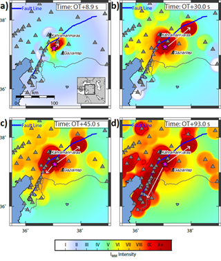
In their recent paper, the team demonstrates the effectiveness of their advanced EEW system, applied to the magnitude 7.8 earthquake that struck the Turkey-Syria border region in February 2023. Their approach uses a sophisticated ground-motion prediction method based on the detection of primary (P) waves, which allows for the real-time identification of areas where ground shaking is likely to exceed predefined thresholds.
The system’s performance was validated through a retrospective analysis of hundreds of accelerometer readings near the earthquake’s source. Remarkably, an alert was generated approximately 10 seconds after the earthquake’s origin, with a 95% success rate in notifying sites within the affected zone, providing lead times of 10 to 60 seconds in high-risk areas. The study shows that the anticipated strong shaking region could be reliably identified approximately 20 seconds after the rupture initiation.
As time progresses, the system precisely outlines the seismic rupture’s development, highlighting its bilateral propagation in the northeast-southwest direction, as inferred from kinematic source models.
These findings indicate that P-wave-based EEW systems can deliver timely and accurate alerts, significantly reducing potential damage and enhancing safety in earthquake-prone regions.
You can read the article at https://www.nature.com/articles/s43247-024-01507-3
- Published in New publications, News
Publication: User-based analysis of practitioners’ needs to make earthquake warnings more actionable
")
In response to seismic risk, particularly in the vulnerable French West Indies, researchers Samuel Auclair, Aude Nachbaur, Pierre Gehl, Yoann Legendre, and Benoit Vittecoq from BRGM (French Geological Survey) collaborated with local stakeholders from Martinique (Caribbean) to assess the relevance and feasibility of implementing three advanced earthquake alert systems. Their study evaluated three main types of solutions: Operational Earthquake Forecasting (OEF) for probabilistic forecasts, Earthquake Early Warning (EEW) for imminent tremor alerts, and Rapid Response to Earthquakes (RRE) to assess post-quake impacts. This approach aligns with the goals of the GOBEYOND project, focusing on enhancing disaster resilience and supporting user-centered alert systems across multiple contexts.
The research applied a user-centered, multi-step methodology involving online surveys, targeted interviews, and workshops with key stakeholders in Martinique. The study revealed that while OEF could improve risk awareness, its effectiveness is hindered by public skepticism and challenges in communicating probabilistic forecasts. EEW was particularly valued for its ability to trigger immediate protective measures, but stakeholders noted that brief warning times could limit its impact. The RRE system was widely recognized as crucial for immediate post-earthquake assessments, aiding in prioritizing emergency responses.
Key findings highlighted the need for an “informational continuum” integrating these systems to provide cohesive support across pre-, during-, and post-earthquake phases. Stakeholders emphasized that false alarms and inadequate communication could erode trust, underscoring the importance of involving end-users in designing alert dissemination methods.
Overall, this research supports the GOBEYOND mission by providing actionable insights for implementing effective, user-centered seismic alert systems in the French West Indies and similar regions globally.
You can read the article at https://doi.org/10.1016/j.ijdrr.2024.104932.
- Published in New publications, News
GOBEYOND’s 2nd Plenary Meeting

2nd GOBEYOND Plenary Meeting: A Collaborative Step Forward
From October 15th to 17th, 2024, the 2nd GOBEYOND Plenary Meeting took place in Setúbal, Portugal, marking a significant milestone in our collective journey toward building a more resilient future. Over three dynamic days, GOBEYOND partners came together to reflect on the project’s progress, share valuable insights, and map out the next steps in our mission. The meeting was characterized by engaging presentations, lively discussions, and a strong spirit of collaboration, highlighting the dedication of everyone involved.
Key Highlights from the Plenary:
- Advancements in Pilot Sites and Living Labs: Partners provided updates on the activities in the pilot sites and the successful organization of workshops and Living Labs. These activities play a crucial role in engaging with end-users and refining our tools through a co-creation approach.
- Project Progress Updates: The consortium shared the latest developments on key components like the GOBEYOND Multi-Risk Impact-Based Early Warning System (MR-IEWS), EW4Europe, and EW4Med, reaffirming our commitment to delivering robust early warning solutions that meet the needs of diverse communities.
- Engaging with Local Stakeholders: The meeting featured a special presentation of the project’s objectives to Setúbal’s municipal risk management services and other local stakeholders, emphasizing our focus on fostering local collaboration and creating real-world impact.
A heartfelt thank you to the Municipality of Setúbal for hosting this important plenary meeting. The mayor of Setúbal welcomed us warmly, expressing strong local interest in enhancing emergency management systems, which are crucial for supporting civil protection authorities. During the event, representatives of Setúbal’s Civil Protection presented the local risks they face, such as urban floods, forest fires, earthquakes, and rockfalls as well as the initial version of the Setúbal prototype. They noted that “risks are a reality in the area and they produce damages, casualties, and losses in the community.”
As the GOBEYOND project celebrates its first year, the progress achieved thus far lays a solid foundation for the work ahead. The advancements made during this period energize us for the upcoming phases, and we look forward to shaping a future where communities are better equipped to face the challenges of tomorrow.

- Published in Consortium Meetings, News
GOBEYOND’s First Living Lab in Attica: A Step Towards Enhanced Civil Protection
")
On July 5th, 2024, the GOBEYOND project marked a significant milestone with the organization of its first Living Lab in the Attica region of Greece. This event, co-organized by the Civil Protection Office of the Region of Attica and DRAXIS Environmental, brought together a diverse group of 15 local stakeholders, including Civil Protection Authorities from Piraeus and other municipalities, representatives from the Fire Department, the Hellenic Rescue Team and the National Observatory of Athens.
The primary objective of the Living Lab was to engage these key stakeholders in identifying existing limitations, better understand the needs of end-users and align the GOBEYOND solutions to meet these needs effectively. The project places significant emphasis on co-creation, so the event prioritized an inclusive and participatory framework where participants actively contributed their expertise.
The session introduced participants to the project’s goals, initiatives, and pilot demonstrations and highlighted the Multi-Risk Impact-based Early Warning System (MR-IEWS) that is being developed for geohazards and weather/climate events.

The event sparked very interesting discussions about the daily challenges faced by Attica’s Civil Protection Authorities and the various hazards impacting the region, such as floods, fires and earthquakes. Participants expressed keen interest in the MR-IEWS being developed by GOBEYOND and discussed how it could enhance their current practices by providing timely and accurate information, allowing for better preparedness, resource allocation, and coordinated response to natural hazards, ultimately reducing the impact on communities and infrastructure. The exchange of ideas and experiences helped identify specific requirements that would make the tools more effective and user-friendly.
Overall, the first Living Lab was a successful step in fostering collaboration and innovation among key stakeholders. By aligning GOBEYOND’s solutions with the real-world needs of end-users, the project is well on its way to strengthening resilience and promoting sustainable practices for mitigating the impact of natural hazards and disasters globally.
More Living Labs are set to follow, both in Attica as well as Andalusia and Campania. These initiatives will continue to build on the collaborative spirit and innovative solutions, further enhancing the project’s results.


- Published in Living Labs, News
GOBEYOND’s 1st Plenary Meeting

Exciting Updates from the 1st Plenary Meeting of the GOBEYOND Project
We are thrilled to announce the successful conclusion of the 1st Plenary Meeting of the GOBEYOND project! Over three days of engaging discussions, our partners came together to discuss the course of the project. Here are some highlights from the event:
- Insightful Visit to Predict Services: Our partners at Predict Services generously hosted the meeting, providing an enriching experience for all attendees. They opened their doors, offering a comprehensive tour of their facilities and showcasing their services.
- Dynamic Roundtable Discussion: A highlight of the meeting was a roundtable session facilitated by Philippe Quevauviller. The discussion centered on the importance of co-creating platforms and response systems, with partners sharing insights into prioritizing end-users’ needs.
- Significant Progress and Presentations: Throughout the meeting, many presentations were delivered, reflecting the dedication and expertise of our partners. Significant progress was made on various fronts, setting the stage for continued progress.
As we reflect on the accomplishments of the 1st Plenary Meeting, we look forward to our next gathering!
- Published in Consortium Meetings, News
- 1
- 2