The GOBEYOND Product Catalogue provides an overview of the products and models developed within the project. It brings together information submitted by the project partners, presenting solutions related to geo- and weather-related hazards across different geographical sacles. The catalogue includes products implemented both within and outside the GOBEYOND Processing Core.
Models
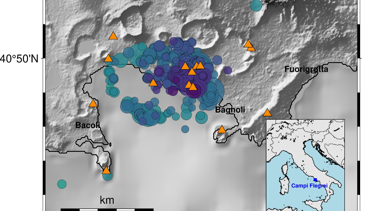
Earthquake Early Response and Impact Assessment model for the Campi Flegrei area
The earthquake early response model relies on three basic ingredients: An on-site Earthquake Early Warning algorithm (Caruso et al., 2017), adapted to operate using only one second of seismic signals from earthquakes in the Campi Flegrei...
Earthquakes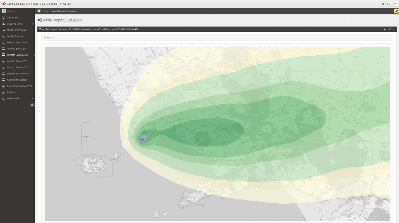
EASE – Earthquake and Ashfall Scenario Evaluation
EASE is an impact scenario assessment model developed by UNINA-PLINIVS to support civil protection planning and emergency management in volcanic areas. It estimates expected damage from precursor earthquakes and volcanic ash fall by integrating hazard...
Earthquakes
Flash Flood Early Warning System (FF-EWS)
Algorithm for estimating hourly forecasts of flash flood impact levels over the river network for the next 6 hours. It integrates precipitation from radar mosaic derived nowcasts and forecasts with information about population and critical...
Flash Floods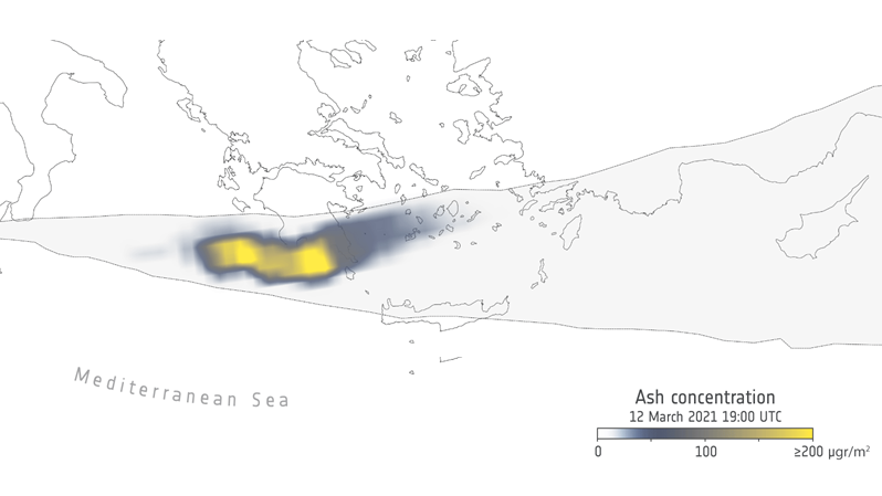
FLEXPART Lagrangian Model
FLEXPART is a state-of-the-art Lagrangian particle dispersion model (Kristiansen et al., 2014; Pisso et al., 2019; Stohl et al., 2011) widely used for simulating the atmospheric transport and deposition of aerosols and trace gases, including...
Volcanic Eruptions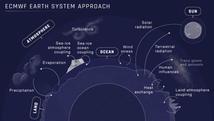
Integrated Forecasting System
The Integrated Forecasting System includes a sophisticated data assimilation system and a global numerical model of the Earth system. The data assimilation system combines the latest weather observations with a recent forecast to obtain the best...
Cold WavesDroughtsFlash FloodsFloodsHeatwavesHydrometeorologicalSnowfallWildfiresWindstorms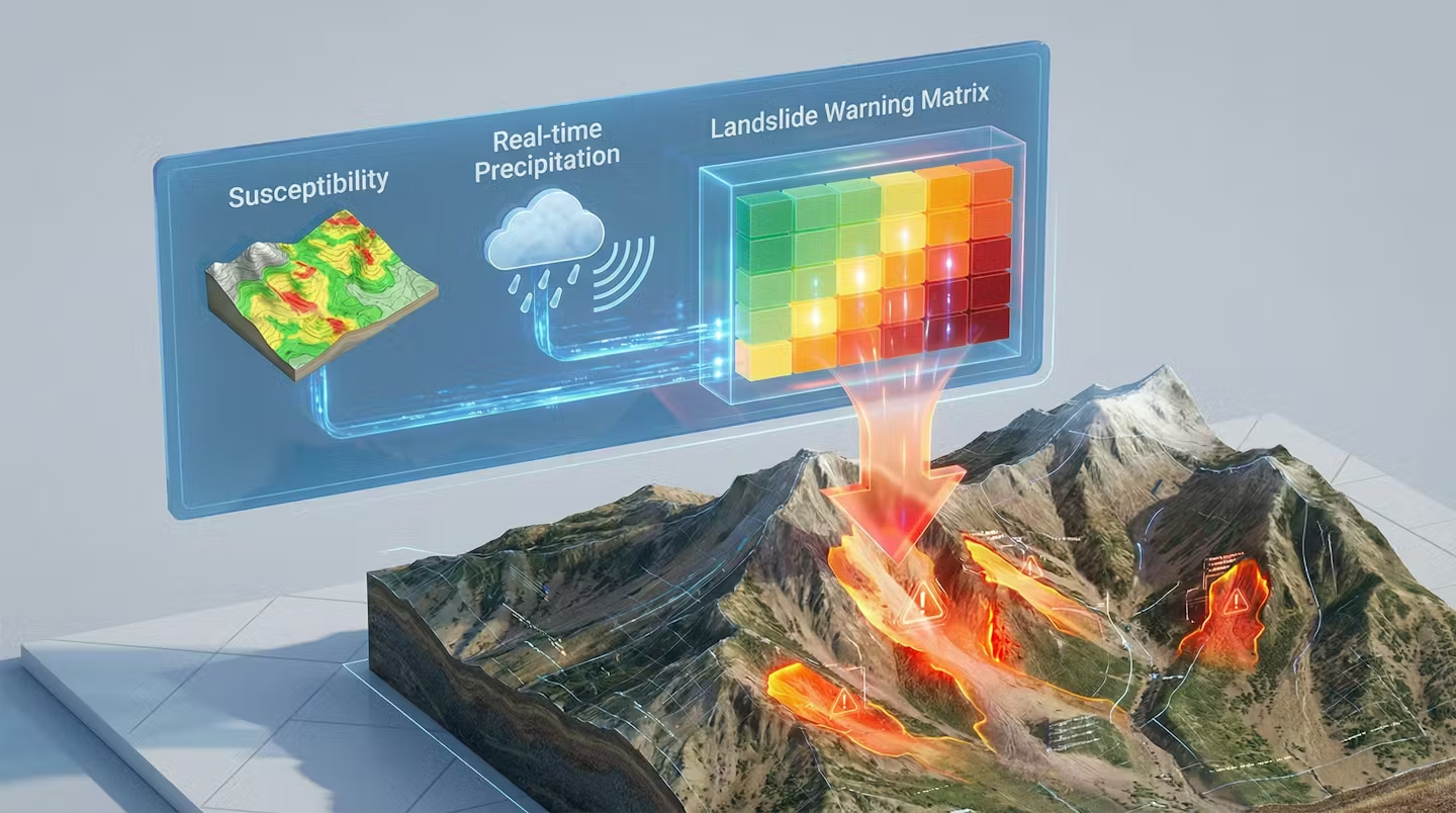
Landslide Early Warning Algorithm
This is an algorithm that provides real-time hazard assessments of rainfall-induced landslides and debris flow, applying a fuzzy-logic approach to combine two key components. - Susceptibility information (static component), obtained from the combination of different geo-morphological...
Debris FlowLandslides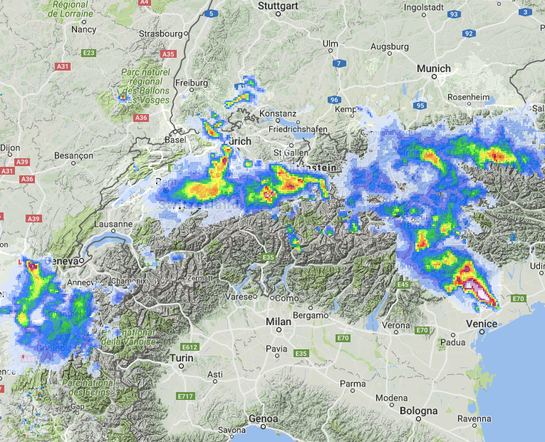
Precipitation Nowcasting Algorithm
Algorithm for very-short-term precipitation forecasting based on the extrapolation of precipitation observations according to the estimated motion. It is composed of two different modules. The first module, precipitation tracking, estimates the motion field with a given...
Hydrometeorological
PROPAGATOR
PROPAGATOR is a stochastic, cellular automata–based wildfire spread simulator designed for operational fire risk assessment and emergency management support. The model represents the landscape as a regular raster grid in which each cell can be...
Wildfires
QLARM
The QLARM software calculates the approximate Intensity of ground motion (or acceleration), expected damage, number of fatalities and injured due to shaking by earthquakes within 26 minutes (median), accompanied by maps of the strongly affected...
Earthquakes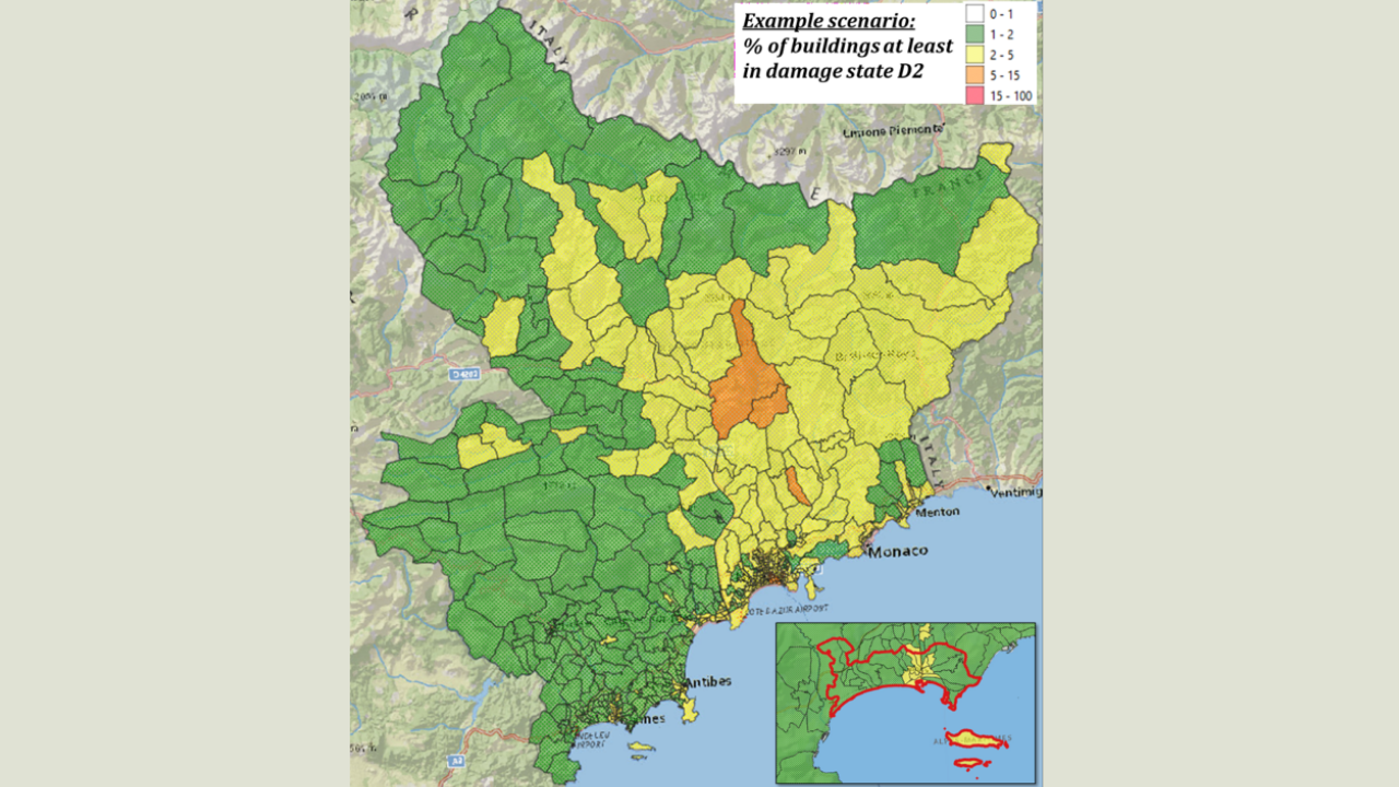
Rapid Seismic Damage Assessment Model for Alpes-Maritimes
The Rapid Damage Assessment model builds upon three main components: - A building exposure database for France (Negulescu et al., 2025), which has been extracted from the building census database at the municipality (and infra-municipality) level,...
Earthquakes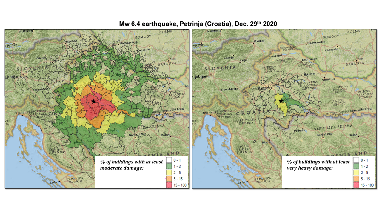
Rapid Seismic Damage Assessment Model for Europe
The Rapid Damage Assessment model builds upon three main components: A building exposure database for Europe (Gehl et al., 2025), which has been assembled by performing a spatial disaggregation of the EFEHR Exposure model (Crowley et...
Earthquakes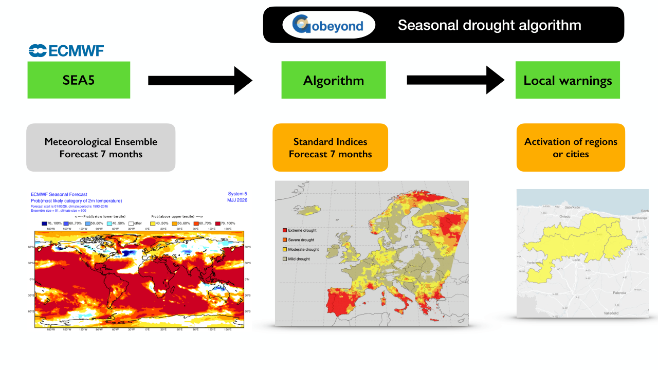
Seasonal Drought Forecast
The European Centre for Medium-Range Weather Forecasts produces each month a European-scale seasonal weather forecast from the SEA5 model. The forecasts consist of a set of 51 equiprobable members that have a daily time resolution...
Droughts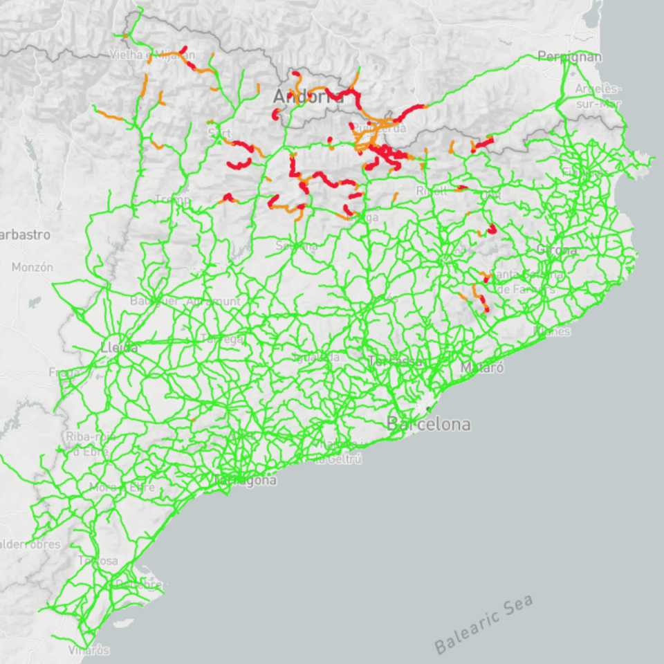
Snow Accumulation and Road Algorithm
Generates hourly forecasts of road conditions across the network for a 3-day horizon. By processing atmospheric inputs from numerical weather prediction (NWP) models - including precipitation, wind, radiation, and dew point - it derives specific...
Snowfall
No matching entries found.

This project has received funding from the European Union’s Horizon Europe programme for research and innovation under grant agreement No. 101121135.